Quick Answer: The history of Sint Maarten begins with Amerindian settlers who called the island Soualiga, the “Land of Salt”, more than 3,000 years ago. In the 1600s Spain, the Dutch Republic and France fought over its salt ponds, and on 23 March 1648 the Dutch and French divided the island under the Treaty of Concordia. Salt and plantations worked by enslaved Africans drove the economy until abolition, in 1848 on the French side and 1863 on the Dutch side. Duty-free status in 1939 and an airstrip in 1943 opened the way to tourism. Since 10 October 2010 the Dutch side has been a self-governing country within the Kingdom of the Netherlands, and since 2007 the French side has been an overseas collectivity of France.
Table of Contents
- St Maarten history at a glance
- Before the Europeans: Soualiga, the Land of Salt
- Columbus and a name that may have moved
- Salt, Fort Amsterdam and the Spanish years
- The Treaty of Concordia: how the island was divided
- Philipsburg and Marigot: two capitals, two characters
- Salt, sugar and slavery
- From duty-free port to tourism economy
- Hurricanes Luis and Irma
- Who governs Sint Maarten today?
- Where the history shows up in today’s neighborhoods
- Frequently asked questions
- What the island’s history means for people choosing to live here
St Maarten history at a glance
The island is small, roughly 87 square kilometres (about 34 square miles), but its timeline is crowded. These are the dates that explain most of what you see today.
| Date | What happened |
|---|---|
| c. 1800 BC or earlier | First known inhabitants: semi-nomadic hunter-fisher-gatherers. Published estimates of the earliest presence range from about 1800 BC to 3000 BC. |
| c. AD 800 | Arawak-speaking communities from the Orinoco basin are established. The island is known as Soualiga, “Land of Salt”. |
| 11 November 1493 | Columbus records the name San Martín on his second voyage. He does not land. |
| 1631 | The Dutch found a settlement to harvest salt and build Fort Amsterdam. |
| 1633 | Spain captures the island and holds it for about fifteen years. |
| 1644 | Peter Stuyvesant fails to retake the island for the Dutch. |
| 23 March 1648 | France and the Dutch Republic sign the Treaty of Concordia, dividing the island. |
| 1763 | Philipsburg is founded on the sandbar between Great Bay and the Great Salt Pond. |
| 1789 | Fort Louis is built above Marigot. |
| 1817 | The border is formally fixed after repeated changes of control. |
| 1848 | France abolishes slavery, including on the French side of the island. |
| 1 July 1863 | The Netherlands abolishes slavery in its Caribbean colonies. |
| 1939 | The Dutch side is declared a duty-free port. |
| 1943 | First commercial flight lands at the wartime airstrip that becomes Princess Juliana International Airport. |
| 1949 | Salt production on the Dutch side ends. |
| 5 September 1995 | Hurricane Luis strikes. |
| 15 July 2007 | French Saint-Martin becomes an overseas collectivity, separate from Guadeloupe. |
| 10 October 2010 | Sint Maarten becomes a constituent country within the Kingdom of the Netherlands. |
| 6 September 2017 | Hurricane Irma strikes as a Category 5 storm. |
| 2023 | France and the Netherlands sign an agreement settling the boundary at Oyster Pond. |
Before the Europeans: Soualiga, the Land of Salt
People lived on the island long before any European chart showed it. Archaeological finds point to hunter-fisher-gatherer groups well over 3,000 years ago, and researchers place Arawak-speaking communities from the Orinoco basin of South America on the island by around AD 800. Later, Kalinago (Carib) groups moved up the island chain and displaced or absorbed them.
Two Amerindian names survive. Soualiga is translated as “Land of Salt”, a reference to the natural salt pans that would later draw the Dutch. Oualichi is usually translated as “land of women”, and the tourism bureau renders it as “land of the brave and beautiful women”. Sources disagree about which people used which name, so it is safest to treat both as recorded Amerindian names for the island and leave it there.
The salt pans themselves are still part of the landscape. If you want the natural history behind them, our earlier piece on the salt ponds of St. Maarten explains how they formed and what lives in them now.
Columbus and a name that may have moved
The traditional account says Christopher Columbus sighted the island on 11 November 1493, the feast day of St Martin of Tours, and named it Isla de San Martín. He did not land, and Spain made no attempt to settle it.
That account is contested. Several historians, and the Dutch-side tourism bureau itself, note that the island Columbus named that day was probably Nevis, and that the name migrated to the present island later, as early charts of the Leeward Islands were copied and corrected. What is not in dispute is the date. Both sides of the island still mark 11 November as Sint Maarten Day, or St Martin’s Day, and it is a holiday the two sides observe together.
Salt, Fort Amsterdam and the Spanish years
Salt is why Europeans came. In the 1600s it was the main way to preserve fish and meat, and the Dutch needed a great deal of it. Dutch ships were scouting the Great Salt Pond by the 1620s, a small group of French families had settled on the northern side by about 1629, and in 1631 the Dutch established a settlement under their first governor, Jan Claeszen van Campen. They built Fort Amsterdam on the peninsula between Great Bay and Little Bay, where its ruins still stand.
Spain, then at war with the Dutch Republic, reacted quickly. A Spanish force took the island in 1633, expelled the settlers and built a fort of its own at Point Blanche. In 1644 Peter Stuyvesant, then the Dutch director at Curaçao and later director-general of New Netherland, led an expedition to take it back. The siege failed, and Stuyvesant lost his right leg to a cannonball.
Spain eventually decided the island was not worth the cost of a garrison. Its troops were withdrawn in 1647 and 1648, as the long war with the Dutch came to an end, and French and Dutch settlers returned almost immediately.
The Treaty of Concordia: how the island was divided
The island is divided because of one agreement. On 23 March 1648, on the hill now called Mount Concordia, the French governor Robert de Longvilliers and the Dutch governor Martin Thomas signed the Treaty of Concordia. France kept the northern area it occupied and the coast facing Anguilla. The Dutch kept the fort and the land around it on the south coast. The treaty also allowed residents of both sides to share the island’s resources and move freely, which is why there has never been a hard border.
The outcome was a split of roughly 60 to 40: about 53 square kilometres (20 square miles) for France and about 34 square kilometres (13 square miles) for the Dutch. That makes it the smallest inhabited island in the world shared by two nations, a claim made often and rarely challenged.
Two details are worth separating:
- The footrace is folklore. The popular story says a Frenchman and a Dutchman walked the coastline in opposite directions to set the boundary, and that the Frenchman covered more ground because he drank wine while the Dutchman drank gin. It is a good story with no documentary evidence behind it.
- The border did not settle in 1648. Control shifted repeatedly during the colonial wars of the next 170 years, with sources counting sixteen changes, before the boundary was formally fixed in 1817. One last ambiguity, the line through Oyster Pond on the east coast, was addressed by an agreement signed by France and the Netherlands in 2023.
Today the crossing is marked by little more than monuments and road signs. You pass one on the road between Cole Bay and Bellevue, usually without slowing down.
Philipsburg and Marigot: two capitals, two characters
The two capitals grew up for different reasons, and it still shows.
Philipsburg
Philipsburg was founded in 1763 and named for John Philips, a Scottish captain in Dutch service who had expanded the salt works a generation earlier. Some sources give 1733, the year Philips took up his post, as the founding date. The town sits on a sandbar barely 500 metres wide between Great Bay and the Great Salt Pond, which is why it has only two main streets running its length: Front Street and Back Street. The white wooden Courthouse on Front Street dates from 1793 and is still in use. For a sense of how the old town works as a place to live and do business now, see our Philipsburg neighborhood page.
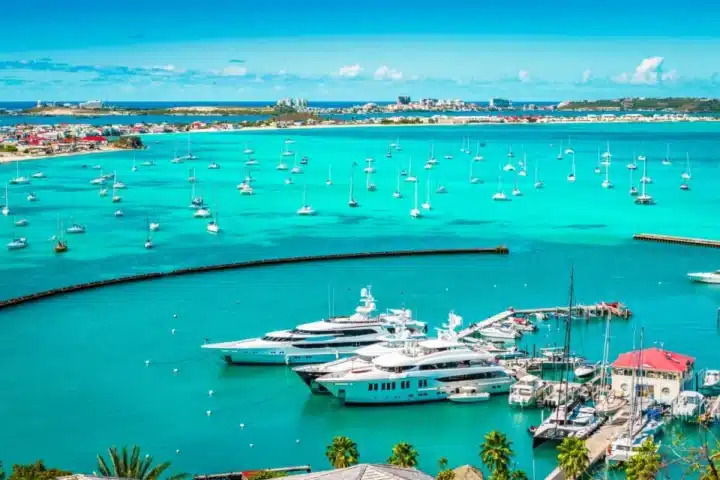
Marigot
Marigot takes its name from the marshes that once surrounded it. It developed as the French side’s port, and in 1789 Fort Louis was built on the hill above the bay to protect the warehouses along the waterfront. The French side was administered through Guadeloupe from 1763 and remained attached to it for more than two centuries, which is one reason Marigot kept the feel of a French provincial town while Philipsburg became a trading port.
The difference carried into language. Dutch and English are the official languages on the Dutch side and French on the French side, but English is the everyday language almost everywhere, as we explain in our guide to the languages spoken on St. Maarten and St. Martin.
Salt, sugar and slavery
For three centuries the island’s economy rested on two things: salt raked from the ponds and crops grown on small plantations, mainly sugar, with cotton and tobacco alongside. Both depended on enslaved Africans. The work in the salt pans was done by hand in brine and full sun, and the local tourism authority’s own history describes the conditions as appalling. The Salt Pickers monument in Philipsburg commemorates the people who did it.
France abolished slavery in its colonies in 1848, and the decree took effect on the French side at the end of May that year. Dutch law did not change until 1 July 1863. On an island with an open border, that fifteen-year gap could not hold. Enslaved people on the Dutch side could reach free soil by walking north, and in practice slavery on the Dutch side broke down long before it was abolished in law. That episode is documented in an archive collection recognised by UNESCO’s Memory of the World programme for Latin America and the Caribbean under the title “Route to Freedom”. The first of July is still observed as Emancipation Day.
Salt outlasted the plantations. Production is reported to have peaked around 1850 at more than 330,000 barrels a year, and steam power arrived in the 1860s. The industry then declined through the early twentieth century and ended on the Dutch side in 1949. With little work at home, many islanders left for jobs elsewhere in the Caribbean, and the population stayed small.
From duty-free port to tourism economy
Three decisions in quick succession changed the island’s direction.
- 1939: duty-free status. Import and export duties were abolished on the Dutch side, which turned Philipsburg into a regional shopping port and still shapes Front Street today.
- 1943: an airport. A wartime military airstrip opened to commercial traffic, with the first commercial flight landing on 3 December 1943. It was later named for Princess Juliana of the Netherlands, who visited in 1944, and became the main gateway to this part of the Caribbean.
- 1950s onward: hotels. The Dutch side began developing tourism in the 1950s. The French side followed roughly two decades later.
Growth after that was rapid. The Dutch side’s population rose from roughly 5,000 at mid-century to around 60,000 by the mid-1990s, as resorts, casinos, marinas and a cruise port were built around Great Bay, Simpson Bay and the western lowlands. Some landmarks of that era are still part of the property conversation: the former Mullet Bay resort, covered in our Mullet Bay real estate guide, and the La Belle Creole resort property on the French side.
Hurricanes Luis and Irma
Two storms mark the modern period, and both changed how the island builds.
- Hurricane Luis, 5 September 1995. A Category 4 hurricane whose eyewall passed just northeast of the island with sustained winds of around 135 mph. Roughly 1,500 boats had taken shelter in Simpson Bay Lagoon, and nearly 1,300 of them were sunk or driven aground. Damage on the Dutch side is widely cited at about US$1.8 billion. Several large resorts never reopened.
- Hurricane Irma, 6 September 2017. A Category 5 hurricane that crossed the island at peak intensity, with sustained winds of about 180 mph. Published estimates say around 70 percent of homes on the Dutch side were destroyed or badly damaged and about 95 percent of buildings on the French side suffered some damage. The airport terminal was wrecked. A rebuilt terminal reopened in stages, with the new arrival hall opening in October 2024.
Each storm was followed by reconstruction to a higher standard, and the difference between pre-Irma and post-Irma construction is now one of the first questions buyers ask. We cover the detail in our guide to post-Irma building codes in Sint Maarten.
Who governs Sint Maarten today?
Sint Maarten is a self-governing country within the Kingdom of the Netherlands. It is not an independent sovereign state, and it is not part of the Netherlands proper.
- The Dutch side. Sint Maarten was part of the Netherlands Antilles from 1954. After a referendum in 2000 and years of negotiation, the Netherlands Antilles was dissolved on 10 October 2010 and Sint Maarten became one of four countries in the Kingdom, alongside the Netherlands, Aruba and Curaçao. It has its own parliament, prime minister and laws. The Kingdom remains responsible for defence and foreign affairs. The capital is Philipsburg.
- The French side. Saint-Martin was part of the French overseas department of Guadeloupe until residents voted in 2003 to separate from it. Since 15 July 2007 it has been an overseas collectivity of France, with Marigot as its capital. It is an outermost region of the European Union and uses the euro.
So one island runs on two legal systems, two tax regimes and two sets of property rules. That is not a curiosity for buyers. It decides how title is registered, which notary handles the transfer and what taxes apply, which is why we compare the two in detail in Dutch side vs French side: the buyer’s comparison. On the Dutch side, history also explains why some land is freehold and some is held on long lease from the government, a distinction covered in our guide to freehold vs long-lease land.
Where the history shows up in today’s neighborhoods
You do not need a museum ticket to see most of this. Much of it sits inside the areas where people now live.
| Area | What to look for | Period |
|---|---|---|
| Philipsburg | The sandbar street plan, the 1793 Courthouse, the Great Salt Pond and the Salt Pickers monument | Salt trade, 1700s |
| Little Bay | The ruins of Fort Amsterdam on the headland | 1631 onward |
| Point Blanche | The site of the Spanish fort above the harbour | 1633 to 1648 |
| Cole Bay and Bellevue | The open border crossing and its monument | 1648 treaty |
| Marigot | Fort Louis and the waterfront it was built to defend | 1789 |
| Simpson Bay | The lagoon, the airport and the old fishing village between them | 1943 onward |
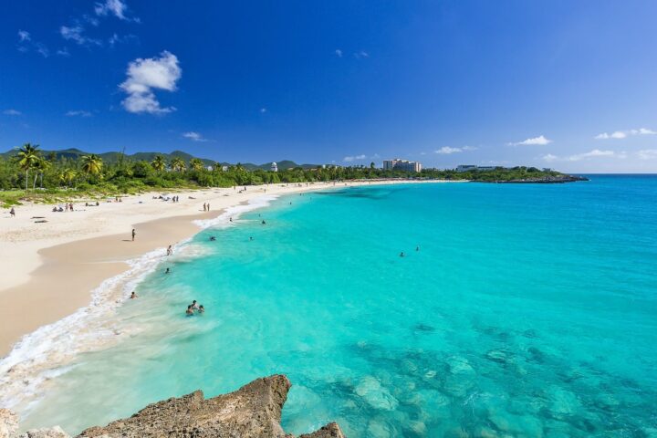
| Maho and Mullet Bay | The runway-end beach and the former resort lands | Tourism era |
| Oyster Pond | The bay where the boundary was finally settled | 2023 |
The same areas are covered from a living-there point of view on our neighborhood pages for Simpson Bay, Maho and Oyster Bay, and you can see how they sit in relation to each other on our map of SXM areas.
Frequently asked questions
Is St Maarten a country?
Yes, in a specific sense. Since 10 October 2010 Sint Maarten has been a constituent country within the Kingdom of the Netherlands, with its own government, parliament and laws. It is not a fully independent state: the Kingdom handles defence and foreign affairs. It covers only the southern part of the island. The northern part, Saint-Martin, belongs to France.
Who owns St Maarten?
Nobody “owns” the island in a single sense. The southern part, Sint Maarten, is a self-governing country within the Kingdom of the Netherlands. The northern part, Saint-Martin, is an overseas collectivity of France. The division dates from the Treaty of Concordia of 1648.
Why is St Martin divided between the Dutch and the French?
Both nations had settlers on the island when Spain withdrew in 1647 and 1648. Instead of fighting over it, their governors signed the Treaty of Concordia on 23 March 1648, giving France the north and the Dutch the south. The border was formally fixed in 1817.
Which side of the island is bigger?
The French side. Saint-Martin covers about 53 square kilometres (20 square miles) and Dutch Sint Maarten about 34 square kilometres (13 square miles). The Dutch side has the larger population, the international airport and the cruise port.
What does Soualiga mean?
Soualiga is an Amerindian name for the island, translated as “Land of Salt”. It refers to the natural salt ponds, the largest of which is the Great Salt Pond behind Philipsburg.
When was Philipsburg founded?
Philipsburg was founded in 1763 and named for John Philips, a Scottish captain in Dutch service. Some sources give 1733, the year Philips took up his post on the island.
When was slavery abolished on St Maarten?
In 1848 on the French side and on 1 July 1863 on the Dutch side. Because the border was open, enslaved people on the Dutch side could reach freedom by crossing north after 1848, and slavery on the Dutch side broke down in practice well before 1863.
Is there a border control between the Dutch and French sides?
No. There are no routine checkpoints, and people cross freely by road many times a day. The Treaty of Concordia allowed free movement between the two sides in 1648, and that arrangement has held ever since.
What the island’s history means for people choosing to live here
Most of what makes this island distinctive in the Caribbean traces back to a handful of events: a salt pond that attracted the Dutch, a treaty that divided the land without building a wall, a duty-free decision in 1939, an airstrip in 1943 and two hurricanes that forced a rebuild. Together they produced a small island with two governments, three working languages, a trading-port economy and a housing stock that is, in large part, newer and stronger than it was a decade ago.
For anyone looking at property, that history is practical. It explains why a condo in Simpson Bay and a villa a few kilometres away in Terres Basses are bought under different laws, why construction date matters, and why each area has its own character. You can compare communities on our Sint Maarten real estate page, or contact our team if you would like local context on a particular area.